Do you want to stay in your home?
If the bank will not work with you, we can try to match you with an investor who may assume the mortgage note and negotiate terms that could help you stay in your home.
We The People News • Foreclosure Rights Notification
$679,099.16
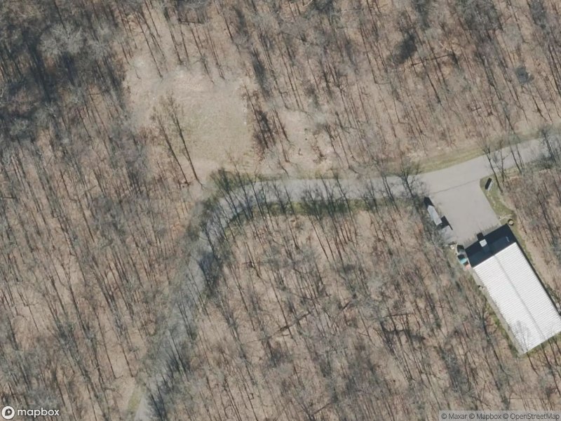
Grand Rapids, Kent County, MI
Courtesy of wtpn.news · Protecting homeowners and advocating for your constitutional freedoms and rights.
This property appears in foreclosure-related records. Michigan homeowners may have rights during the redemption period under MCL 600.3240. This page is informational and not legal advice.
If the bank will not work with you, we can try to match you with an investor who may assume the mortgage note and negotiate terms that could help you stay in your home.
We can try to put an option together that may help in a difficult time, including support planning so your transition is organized and documented.
In some situations we can leverage redemption timing to negotiate a potential cash-for-keys agreement that helps cover moving expenses.
Full published notice text from legalnews records.
Attention homeowner: If you are a military service member on active duty, if your period of active duty has concluded less than 90 days ago, or if you have been ordered to active duty, please contact the attorney for the party foreclosing the mortgage at the telephone number stated in this notice. Notice of foreclosure by advertisement. Notice is given under section 3212 of the revised judicature act of 1961, 1961 PA 236, MCL 600.3212, that the following mortgage will be foreclosed by a sale of the mortgaged premises, or some part of them, at a public auction sale to the highest bidder for cash or cashier's check at the place of holding the circuit court in Kent County, starting promptly at 10:00 AM on MARCH 25, 2026. The amount due on the mortgage may be greater on the day of the sale. Placing the highest bid at the sale does not automatically entitle the purchaser to free and clear ownership of the property. A potential purchaser is encouraged to contact the county register of deeds office or a title insurance company, either of which may charge a fee for this information. Default has been made in the conditions of a mortgage made by Kara Ann Borisch, as Trustee of The Kara Ann Borisch Trust under Trust Instrument dated September 19, 2006, for the Benefit of Matthew Allen Borisch, to Fifth Third Bank, National Association, Mortgagee, dated June 15, 2021 and recorded July 9, 2021 in Instrument Number 202107090077899 Kent County Records, Michigan. There is claimed to be due at the date hereof the sum of Six Hundred Seventy-Nine Thousand Ninety-Nine and 16/100 Dollars ($679,099.16). Under the power of sale contained in said mortgage and the statute in such case made and provided, notice is hereby given that said mortgage will be foreclosed by a sale of the mortgaged premises, or some part of them, at public venue at the place of holding the circuit court within Kent County, Michigan at 10:00 AM on MARCH 25, 2026. Said premises are located in the Township of Cascade, Kent County Michigan, and are described as: Part of the Southwest 1/4 of Section 27 and part of the Northwest 1/4 of Section 34, Town 6 North, Range 10 West, Cascade Township, Kent County, Michigan, described as: Commencing at the Northwest corner of said Section 34; thence North 88 degrees 48 minutes 57 seconds East 60.97 feet along the North line of said Northwest 1/4 to the Place of Beginning of this description; thence North 37 degrees 59 minutes 17 seconds East 120.08 feet; thence North 73 degrees 51 minutes 01 seconds East 159.08 feet; thence South 55 degrees 54 minutes 00 seconds East 223.57 feet to Reference Point "C"; thence South 55 degrees 54 minutes 00 seconds East 56 feet, more or less, to contour elevation 566 on the left bank of the Thornapple River; thence Southwesterly along said contour line of 656.10 its intersection with a line which bears South 55 degrees 54 minutes 00 seconds East from Reference Point D (Reference Point "D" is located South 34 degrees 06 minutes 10 seconds West 210.00 feet along an intermediate traverse line from the above described reference Point "C"); thence North 55 degrees 54 minutes 00 seconds West 60 feet to Reference Point "D"; thence North 55 degrees 54 minutes 00 seconds West 229.72 feet; thence North 73 degrees 06 minutes 18 seconds West 108.57 feet to the place of beginning.Subject to and together with a 66 foot wide easement for ingress and egress - Private Drive, Described as: Part of the Southwest 1/4 of Section 27, part of the Northeast 1/4 of Section 33 and part of the Northwest 1/4 of Section 34, Town 6 North, Range 10 West, Cascade Township, Kent County, Michigan, described as:Commencing at the Northwest corner of said Section 34; thence North 88 degrees 48 minutes 57 seconds East 60.97 feet along the North line of said Northwest 1/4 to the center point of a 60.00 foot radius circle and the place of beginning of the centerline of a 66.00 foot wide strip of Land; thence South 37 degrees 59 minutes 17 seconds West 31.84 foot: thence Southwesterly 72.41 feet along a 100.00 foot radius curve to the right, the chord of which bears South 58 degrees 43 minutes 52 seconds West 70.84 feet; thence South 79 degrees 28 minutes 27 seconds West 74.99 feet; thence Westerly 47.39 feet along a 300.00 foot radius curve to the left, the chord of which bears South 74 degrees 56 minutes 54 seconds West 47.35 feet; thence South 70 degrees 25 minutes 21 seconds West 50.39 feet; thence Westerly 48.44 feet along a 150.00 foot radius curve to the right, the chord of which bears South 79 degrees 40 minutes 24 seconds West 48.23 feet; thence South 88 degrees 55 minutes 28 seconds West 136.08 feet; thence Southwesterly 90.04 feet along a 75.00 foot radius curve to the left, the chord of which bears South 54 degrees 31 minutes 59 seconds West 84.73 feet; thence South 20 degrees 08 minutes 30 seconds West 242.49 feet; thence Southerly 109.08 feet along a 155.00 foot radius curve to the left, the chord of which bears South 00 degrees 01 minutes 07 seconds East 106.84 feet; thence South 20 degrees 10 minutes 44 seconds East 74.91 feet; thence Southerly 63.49 feet along a 95.00 foot radius curve to the right, the chord of which bears South 01 degrees 01 minutes 54 seconds East 62.32 feet; thence Southwesterly 136.42 feet along a 360.00 foot radius curve to the right, the chord of which bears South 28 degrees 58 minutes 17 seconds West 135.60 feet; thence Southwesterly 89.48 feet along a 110.00 foot radius curve lo the right, the chord of which bears South 53 degrees 07 minutes 53 seconds West 87.04 feet; thence South 86 degrees 26 minutes 09 seconds West 273.76 foot; thence Southwesterly 138.32 feet along a. 135.00 foot radius curve to the Left, the chord of which bears South 57 degrees 04 minutes 58 seconds West 132.35 feet: thence South 27 degrees 43 minutes 48 seconds West 71.01 feet; thence Southerly 96.20 feet along a 200.00 foot radius curve to the Left, the chord of which bears South 13 degrees 57 minutes 00 seconds West 95.28 feet; thence South 00 degrees 10 minutes 12 seconds West 23.43 feet; thence Southerly 129.35 feet along a 300.00 foot radius curve 10 the right; thence chord of which bears South 12 degrees 31 minutes 20 seconds West 128.35 feet; thence South 24 degrees 52 minutes 28 seconds West 95.55 feet; thence Southerly 44.46 feet along a 125.00 foot radius curve to the Left, the chord of which bears South 14 degrees 41 minutes 08 seconds West 44.22 feet to the South line of the North 1/4 of said Northeast 1/4 of Section 33, the Northerly R.O.W, line of Kilmer Drive, Reference Point "H" and the place of ending of the centerline of said 66.00 foot wide strip of land. Also, Commencing at aforesaid Reference Point "H"; thence North 89 degrees 38 minutes 15 seconds East 33.16 feet along the South line of the North 1/2 of said Northeast 1/4 of Section 33 to the place of beginning; thence Northerly 29.91 feet along a 92.00 foot radius curve to the right, the chord of which bears North 15 degrees 33 minutes 37 seconds East 29.78 feet; thence North 24 degrees 52 minutes 28 seconds East 46.96 feet; thence South 00 degrees 24 minutes 54 seconds West 54.42 feet to the North line of Thornapple Valley Plat No. 1 (as recorded in Liber 60 of Plats, Page 21, Kent County Records); thence North 89 degrees 35 minutes 06 seconds West 11.88 feet along said North line; thence South 00 degrees 24 minutes 24 seconds West 16.87 feet to the South line of the North 1/2 of said Northeast 1/4 of Section 33; thence South 89 degrees 38 minutes 15 seconds West 15.37 feet along said South line to the place of beginning.Subject to: Existing building and use restrictions, easements of record, reservations and zoning ordinances if any. 5234 Dayenu Dr SE, Grand Rapids, Michigan 49512 The redemption period shall be 6 months from the date of such sale, unless determined abandoned in accordance with MCLA §600.3241a, in which case the redemption period shall be 30 days from the date of such sale. If the property is sold at foreclosure sale, pursuant to MCL 600.3278, the borrower will be held responsible to the person who buys the property at the mortgage foreclosure sale or to the mortgage holder for damage to the property during the redemption period. Dated: February 25, 2026 File No. 26-000580 Firm Name: Orlans Law Group PLLC Firm Address: 1650 West Big Beaver Road, Troy MI 48084 Firm Phone Number: (248) 502.1400 (02-25)(03-18)
Select owner or investor above, then complete the matching form below.